Saturday, December 31, 2011

Happy New Year

Maybe a snowshoe race


Sunday, October 16, 2011

Whats out there

I've been asked about htis photo several times. During the race I got a report about the markers being down between  Anderson lake and Carson lake . While adding new markers at two in the morning I ran into a bear he's out there in the dark.

Phil B

Monday, October 10, 2011

slickrock 100

Well me and Rick went to Moab for the weekend.  Rick was to run the 50
and I was to run an aid station at mile 92. Well Rick bailed on the 50 and
Instead worked the aid station with me thanks Rick.
Instead of mile 92 we were mile 50 and 68 or so. 
Congratulations to all those who  fought through the weather and confusion to finish
Phil B


The wet start

Our humble aid station


We were busy so I only got a few photos

Sunday, September 25, 2011

What you support by running the GM100

 These photographs were taken Sept. 19 to 21, 2011 of fifth graders from Pomona Elementary in Montrose as they attended Camp Redcloud near Lake City.For some kids, it was their first experience camping and all of the students learned how teamwork, overcoming obstacles, and an appreiciation of the outdoors will enrich their lives. A portion of your registration fee went to scholarships for kids who needed help paying for this wonderful outdoor experience.  Thanks for your support!!


Phil B.

Wednesday, September 7, 2011

What a month

Well I'm back. Three days after the race I had my shoulder rebuilt it was more messed up then the MRI showed. I will no longer complain how hard the Kannah creek drop and climb back to the top of the mesa hurts. It's nothing.
Once again we got lucky and had perfect weather again this. On Tuesday after the race it was about 50 degrees on top and pouring rain.
Next years race will be on July 28-29 2012 . Sign up will be on Ultrasignup.

Updates to maps and directions will be on the website next month.

Phil B

Monday, July 25, 2011

2011 Results

Results for the 2011 Grand Mesa 100.
We had 13 Starters for the 100 and  7 Finishers. For the 50 miler we had 16 Starters and 14 Finisher.
For the 37 We had 17 Starters and all Finished. The times and place are on the website.


Sunday, July 24, 2011

Its Over

We would like to thank all the runners and crew who came out and gave our race try. I will get the results up tomorrow. Now Its time to sit back and relax.

  Phil B

Friday, July 15, 2011

trail marking

We will begin trail marking tomorrow. Starting with Kannah creek. If your in town and want tag along drop me an email.  signup ends tomorrow at midnight.

Phil B

Wednesday, July 13, 2011

crag crest

The FS finished clearing the lower loop today. The updated course directions are on the web site, and the maps page has the course broken down into each section in the order you will run them. depending on the distance you are running.

Phil

Sunday, July 10, 2011

Camp grounds

There are 3 forest service campgrounds within a mile of the start. they are
Cobbett lake, Island Lake, and Little Bear.  Island lake has 4wheeler access
so it can be a little noise.

Phil B

Pacers

There are a few people looking for pacers if you want to pace . leave a comment or email me and I will pass along your Info.

Trail update

The FS trail crew is kicking ass. They have about a 1/2 to 3/4 mile off this left to clear.
When they are done it looks like this.
Other useful information . there have been fresh bear tracks on every trail I checked last week, even along the top of crag crest. Be alert at dawn and dusk.

I recommend  having dry shoes  in your drop bags at flowing park for 50 and 100 milers
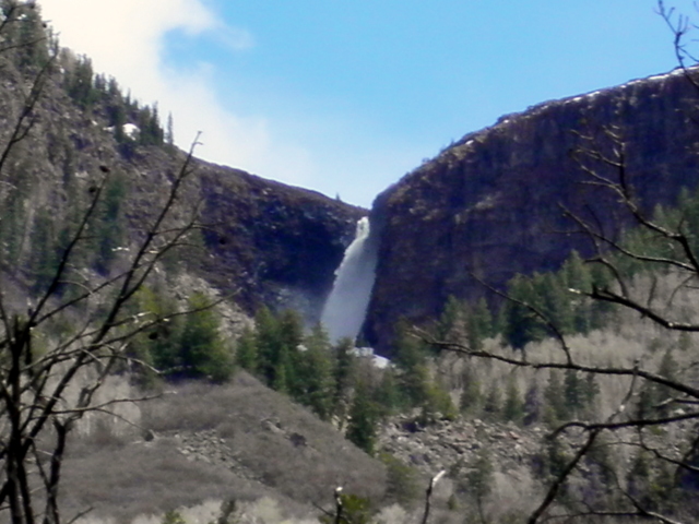
37 milers your just going to go back thru the water right away. All the reservoirs between the
lodge and flowing park are full and running over the spillways so the creek crossing are about knee deep.
Phil B

Tuesday, July 5, 2011

Talked with the FS service about the downed trees and they are going to try and clear the trail before race day. If they can not get it cleared we will be using the road.

Phil  B

Sunday, July 3, 2011

Trail conditions: the good ,the bad, and the ugly

The good most of the course has cleared up nicely.
The bad there will be some snow left on the crag crest loop. but its not to bad early in the morning it is pretty firm and no post holing.
The ugly The lower loop  of the crag crest trail is impassable .


Grand Mesa 100 hurdle section


Looking down from the crest at the blow down section


There was a big blow down this winter that wiped out the lower loop of the crag crest trail. We are working on two options for this section of the race. The upper loop is in good condition other than some snow drifts, we cleared all the downed  trees on the upper loop yesterday. The first option is there is a road that parallels the lower loop and we are trying to get permission to use the road to complete the loop. the only problem with this is part of the road is on private property . the second option is to do an out and back on the upper loop.
The first option is preferred . I will keep you up to date on this.  Everything else is looking good.

Phil B.

Tuesday, June 28, 2011

100 mile profile 2011

Course profile for the 100 miler for 2011. the big drop in the middle is rather decpetice the section goin down is not as steep as the profile makes it look it is about 3800' of decent over about 8.5 miles with a couple of little climbs. the climb back up is about 4000' in 5.5 miles.  the big differnce over last year is not having to do the 3/4 of mile 1500' clmb at mile 92.

Phil B

Monday, June 27, 2011

Course profile 2011

Here are the 37 and 50 mile profiles  still working on the 100 mile.

37 mile profile


50 mile course
 
The profiles are a little rough and should just be used as a general guide line. When you jam 50 miles in to
a small space the climbs and drops look steeper than they really are.


Phil B

Sunday, June 26, 2011

revised course directions

The revised course directions and maps are now on the web site. I will try to get new course profiles up tonight.

this is the sign in section 4 for the 100 milers

The trail goes straight but the arrow points to the right, go right

The forest service has put up some new markers
 The trail down to Carson lake is a stream right now but will dry out by race day . The trail goes down into the trees in center of  photo.

Phil B

Thursday, June 23, 2011

Blessed with to much Snow

Last week at Island Lake


Today at Lands End Road on top of Mesa
With the hot weather the snow has started to melt fast but where still a month behind. So there is going to be two course changes. One effects all distances and the second only effects the 100 milers. The first changes is we are not going to use the Drop off section . This is the section from flowing park back to the granby aid station. Instead you will return  the same way you come out to flowing park.   The second changes is the Anderson lake to Mesa lake  loop. Instead of doing a loop it will be an out and back to Mesa lake. the reason for this section being changes is there is still 3' to 5' of snow in the trees and the section from Mesa lake back to Anderson lake could be a mud bog on race day.  the drop of f section has a couple of reason for not being used  one is safety the road up to the bottom is almost impassable and if we had to get an injured runner out it would be very difficult, also the trail has several washouts and a lot off trees down.

I will have the course directions on the website updated this weekend.

Phil B

Saturday, June 11, 2011

Questions @ Answers

I have about 1200 reflective markers and I try to place them so you can see a several at one time it just depends on the trail conditions. in some areas their will also be some little signs that have  GM 100  on them.

Weather :  Any thing is possible on the mesa in July.  Last year the weather was clear but about 10 degrees above normal . we had a high of 80 at the star/finish line and a low of 49  . The Low point of the course for the 100 milers hit 99 degrees.  Two days after the race while picking up course markers it hit a high of 49 degrees and I sat under a tree for an hour while it dumped 3' of hail. Be prepared.

Most of the course has a southern exposure so if it is sunny you will need more than two water bottles.
100 milers it is recommended that you use a camel back and  at least one bottle for the section between Carson lake and Lands End you will be hitting this section during the hottest part of the day. there are a couple of stream crossings to cool of in.

Monday, June 6, 2011

June 6 and still snow

Island lake

 Top of the mesa today there is about 250 to 300 % average snow pack left. But it has finale warmed up and is starting to melt fast. most of the snow is gone below 9000'


County line trail


Course markings for this year are

On the left reflector  orange chalk and pink ribbon with black dots

Most of the trail will be mark with the orange chalk intersections will be marked with arrows. there will be some of the ribbon as well. All sections that maybe run after dark will also have the reflectors.

The white spots are the reflectors the the three reflectors are between 50" and 800' away.

I'm using a old Black Diamond head lamp with a 1 watt led.
The white spots are the reflectors at about 600" to a 1000'